I had spent some time in 2020 whilst working on the Mallee Routes project looking for the location of these ruins but I had no luck. They were much further north than I remembered. I was looking around the Palmer area, not north of St Kitts or Dutton or close to Eudunda.
I only decided to drive along this road as a result of seeing some of Graeme Hastwell’s recent images of Tableland Rd. I thought, why not explore Tableland Rd instead of driving the Dutton-Eudunda Rd.on the Murray Plains. It took me ages to find it.
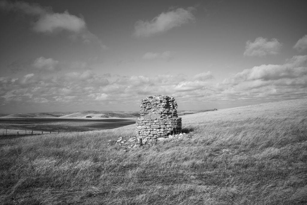
However, I do remember what I was thinking at the time: the harshness of he barren landscape made farming difficult. The ruins signified the white settler yeoman dream of independent land-owning family-based farming turning to nightmares because of the lack of rain.
Update.
Graeme Hastwell made the following comment on Facebook re this post. He says:
I’m not so sure about the yeoman ideal there; from what I can glean of it’s post-European history, right from the first few years of European settlement it was on the eastern flank of Anlaby Station, which was a sheep graziers’ operation in the first decade of the colony and on the drovers’ stock route to Qld. Leakes Pass was named after a drover who moved sheep through there from SA to Qld in the 1840s. After land reforms in the mid-19th C, Anlaby had to sell off part of their holdings, and that seems to have been taken up by German farmers who cultivated the land for wheat.
I gather their ethos was more traditional village subsistence agriculture (in the Wendell Berry sense) than the yeoman ideal. Rainfall is highly variable; most years it’s near the lower end of what’s viable for wheat, but occasionally they get enough rain to grow bonanza crops. Winters can be very bleak, even by the standards of more southerly parts of the Adelaide Hills: think Wuthering Heights or Cold Comfort Farm.Ruin 3 is very odd – I still haven’t figured out what it was. Perhaps it had something to do with some of the nearby small-scale mining operations.
Once in a while when I’m up there one of the locals will stop and have a chat, as you do when you are outside city bounds. I’ve been struck by how much they know of what remains of the natural world there: I’ve participated in conversations about the seasonal movements of grassland birds, or coded discussion of the endangered animals of the region where we don’t actually speak of what we know but signal to each other our awareness. Almost like Freemasons shaking hands. Another facet of the enigma.I take some comfort in that. It’s a damaged landscape, but not one that is ruined. And at least some of the people who manage it care.
One Response
Tableland Rd - The Bowden Archives and Industrial Modernity
[…] recently unearthed a few more 6×6 negatives in the archive from the Tableland Rd series in the eastern Mt Lofty Ranges that were made in the 1980s-early 1990s when I was still had a […]